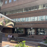


With just nine minutes remaining before his 5 p.m. shift, Chris* peddled his aluminum bike from his Midtown apartment toward the downtown restaurant where he worked as a server. No helmet, headphones playing underground rap music, he glided down the sidewalk along Front Street to pause at the sidewalk’s mouth as it opened to the six-lane behemoth of Forster Street.
Chris said he watched the traffic light controlling Forster Street’s rush-hour traffic turn red, started pedaling, and collided with the front bumper of a silver sedan.
The next thing he remembers was lying on the pavement, thinking, “I got to get up.” With a dented bike, broken leg and blooded face, he could not move.
Chris, who has since recovered, represents one of many Harrisburg residents and visitors who navigate the city without a car, either by need or by preference. Over the years, TheBurg reporters have heard of many other accidents involving pedestrians—and nearly been victims a few times themselves. So, we paired with Steve Cline, owner of map-making project Urban 3D Modeling, to find out how the city interacts with its walking population.
Cline mapped the car crashes that involved pedestrians in Harrisburg by using PennDOT Open Data from 2012 to 2016.
The top four areas of accidents probably won’t surprise those who don’t use cars, and neighborhoods prone to foot traffic showed more incidents.
Cameron and Market streets topped the list with seven crashes involving pedestrians at a single intersection.
A whopping 58 crashes took place along Derry Street. The map shows a concentration along 13th and 17th streets, plus the intersection of Derry and Mulberry streets.
Forster Street, where Chris’ accident took place, clocked in at nine crashes along the downtown portion. Four crashes took place at the 3rd and Forster intersection.
The downtown corridor bordered by Front, Chestnut, 4th and Walnut streets saw 20 crashes with pedestrians. Many took place along Front Street, and three pedestrian crashes (of 25 crashes of all types) took place at Front and Market streets near the Market Street Bridge.
A cross-shaped region around N. 6th and Maclay streets showed 12 crashes with pedestrians out of a total 508 crashes.
“At some point in every journey, everybody’s a pedestrian, even if you park in a lot and you’ve got to cross a street to go to an office,” said Geoffrey Knight, the city’s director of planning. “Pedestrian infrastructure is important for everybody, not just people who rely on walking to get around most of the time.”
A Change
Knight’s office dreams up the “pie in the sky” ideas to design the city for pedestrians—larger sidewalk “bump outs” that trick drivers to slow down, trees placed for shade and safety and well-designed crosswalks.
“From a conceptual standpoint, we are always trying to make the city as accommodating to pedestrians and all road users as possible,” he said.
This perspective on city planning marks a change from past generations.
“A lot of last centuries’ engineering as far as streets … in many cities, was designed to get people in and out the city as fast as possible,” Knight said. “So, now communities are having to correct that.”
Roads such as Forster and Front were widened to accommodate more cars, which benefited commuters, but gave pedestrians dauntingly wide streets to cross.
A few projects are in the works to make the city more appealing for those who don’t drive cars.
A $3 million state grant-funded project is in the works with the goal of transforming the streetscape near the intersection of Mulberry and Derry streets. This Allison Hill intersection, known as Mount Pleasant or MulDer Square, saw nine total crashes, with five incidents involving pedestrians, according to the PennDOT data.
“The purpose of this project is green infrastructure and pedestrian activity because that is what is going to increase property value and safety,” said City Engineer Wayne Martin.
Project leaders also plan to develop a safe path to Cameron Street (following the “goat paths” that walkers already have worn into the dirt) and to transform Nectarine Alley—an alley so rife with potholes that cars cannot pass; I tried it and failed—into a green space.
Martin called this Y-shaped intersection a “sea of asphalt.” A small mini-mart sits at the crux of the Y. The expanse of asphalt makes it difficult for a pedestrian to pop between parked cars to see when a car will whir pass and in which direction.
“What if we made it plaza space, green space,” Martin said about underutilized space. “Give it back to the pedestrian, because it’s not really needed for roadways for traveling vehicles.”
 Pinch Points
Though Derry Street, combined with stretches of S. 13th and S. 17th streets, saw the greatest number of pedestrian-related crashes, the intersection of Cameron and Market streets clocked in as the most dangerous intersection for pedestrians.
Cycling community advocate and founder of the bike repair nonprofit, Recycle Bicycle, Ross Willard called this area a “death wish” to cross.
“We have an island that starts from downtown to Midtown to Uptown,” he said. “[This means the city] has pinch points. All the pinch points are deadly because we have high speeds, lots of walkers and lots of traffic.”
Already this year, on a Monday evening in late January, a taxi driver hit a 25-year-old city resident attempting to cross the four-lane, industrial-zoned behemoth. The pedestrian was taken to Hershey Medical Center because of multiple injuries, according to the Harrisburg Bureau of Police.
Last month, a drunk driver killed a woman walking on State Street, another “pinch point,” on an early Saturday morning.
For many residents and workers, crossing these “death wishes” is a day-to-day necessity. Residents staying at a halfway house on Cameron Street can only bike or walk, Willard said. Knight pointed out that the PA CareerLink Center attracts walkers crossing Cameron Street.
To get to jobs downtown, this intersection presents the most convenient route. Over at Front and Forster, that’s what Chris was doing when he got hit. He was just following his normal daily routine.
Now, about a year after the crash, he’s mostly recovered. He continues to bike (on a new one he called “a beauty”). He said he wears his headphones about half as much.
Most importantly, he’s altered his route. He still needs to bike downtown and cross Forster at Front street. But now he opts for the more controlled crossing at Riverfront Park.
*Chris is a pseudonym for the real biker, who asked not to be named.
Author: Danielle Roth and Steve Cline